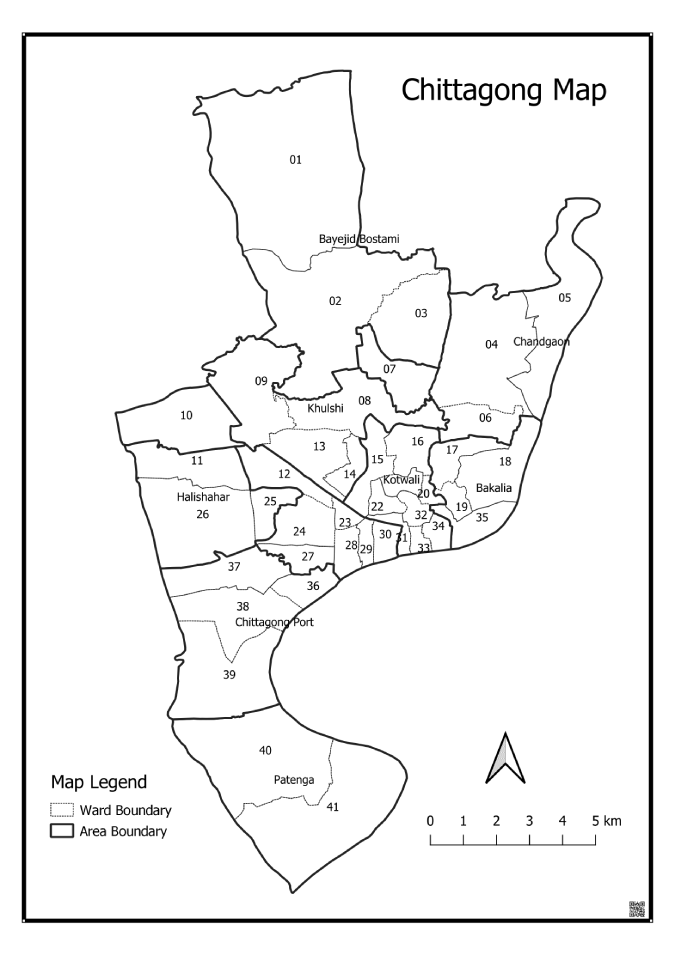
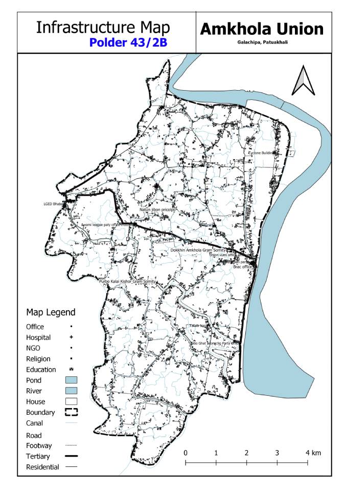
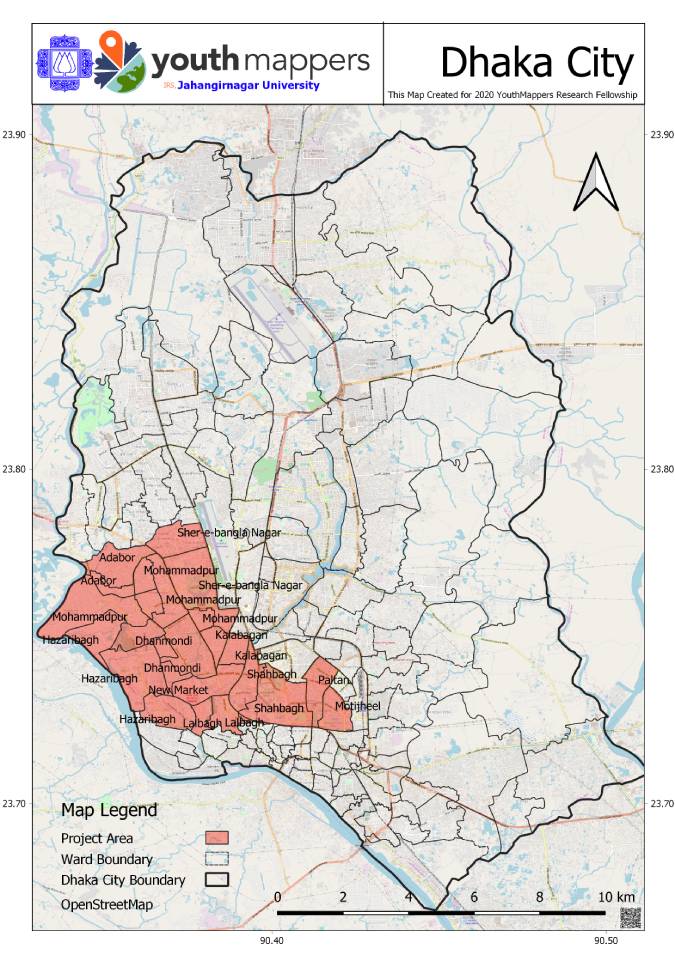
Some of the maps I've made.
I like to collect and utilize geospatial data for help-out to decision makers.
I want to develop my technical skills to address the challenges in geospatial information to improve the Humanitarian and Technical fields.
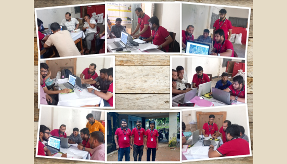
I am currently working for Bangladesh Open Innovation Lab (BOIL), supporting their internal programs and operate field oparetions.
My current interests include using code to make web map, collect geospatial field data using various mobile data collection tools, openstreetmap contributor.
Some of the maps I've made.
Some of the web maps I've made.
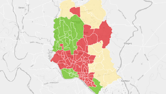
Village Mapping initiative for National Malaria Elimination Program by GROUP MAPPERS .
An initiative for field operation monitoring and reporting.
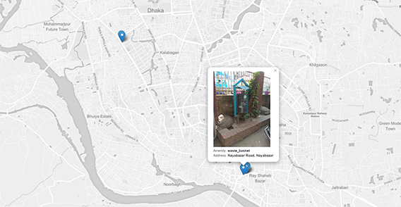
This is an on going Project by YouthMappes DhakaCollege Chapter an initiated to collect all dump point at Dhaka City. Which is supported by Humanitarian OpenStreetMap Team (HOT) Microgrants 2019. This map visualized dump points with its current status.
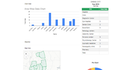
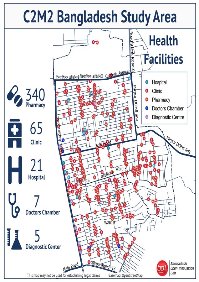
This dashboard is created for Automatically record Health facilities Field Data Collection report .
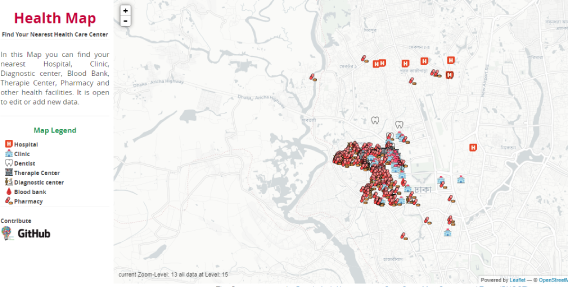
A simple map to explore the Health facilities data from OpenStreetMap Database.
Some of the Blog's I've written.
 Cox's Bazar GOB-UNICEF WASH Programme
 Accelerating Sanitation, Hygiene and Water for All (ASWA II)
 Coastal Polder Water Management and Monitoring
 State of the Map Asia. Dhaka, Bangladesh 2019.
 Dhaka Water Knowledge Days 2019.
 An initiative for low cost Data collection and map Visualization platform.